Amguid Crater
In a remote region of
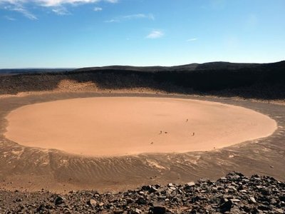
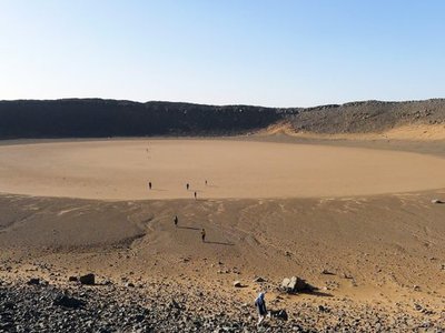
the Sahara Desert, an impact crater was punched into the land less than 100,000 years ago. Measuring some 500 meters (1,640 feet) wide and about 70 meters (230 feet) deep, the Amguid Crater is located in southwestern
Algeria
. On satellite imagery, the white spot of the flat, sandy crater floor is clearly visible; the residue formed by millennia of sporadic rain running into the bowl and evaporating.
The first known record of the Amguid crater in scientific literature was made by the French explorer Roman Karpoff, who noted a possible impact crater from a plane in 1948. The French geologist Jean-Phillippe Lefranc visited the crater in 1969.
The crater is almost perfectly circular, with steep walls and raised rims that are covered with large blocks of sandstone.
Shallow canyons cut through the plateau from east and west and spill out into the Erg Bou Zerafa sand sea to the north. One of the canyon mouths at the waterhole of Aguelman Rahla, has an unusually high concentration of pre-Islamic tombs. Rock art, neolithic tools and other pre-historic relics suggest the entire region was occupied thousands of years ago when the Saharan climate was less arid.
Amguid is the name of the nearest village (and army base) about 100 kilometers (62 miles) to the northeast.