Qurnat As Sawda
Many mountains dwarf Qurnat as Sawda
in size, but few can offer the experience of ascending such beautiful, untrodden terrain. Summiting this peak carries the added satisfaction of seeing a place few visitors to Lebanon ever experience themselves.
Hiding in plain sight, shrouded by political unrest and pushed aside by cultural preference, hiking to the top of Lebanon’s highest point, one is more likely to pass a Bedouin camp with grazing ponies and sheep than a fellow outdoor enthusiast.
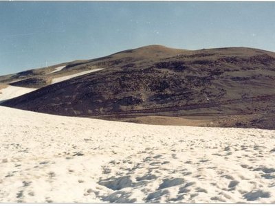
The scenery along the way is spectacular. Expansive desert stretching to all sides is something to behold, especially the sharp juxtaposition of dry rocky soil and permanent snow fields classified as “alpine tundra.” Then, just nine miles east of Qurnat as Sawda’s summit, Mount Lebanon (the common term for the entire range), drops off more than 8,000 vertical feet, revealing breathtaking views and impressive cloudscapes.
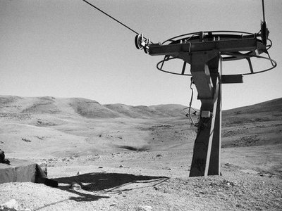
Hikers making the trek in early fall, summer, or late spring will encounter a significant bonus in the seasonally abandoned Cedar’s Ski Resort, whose empty chairlifts to nowhere look post-apocalyptic amidst their Martian surroundings.
The hike itself should be easy enough for any moderately fit individual, but navigation poses something of a challenge. It is advised to thoroughly review online maps, all materials at one’s disposal, and the most recent political movements before departing. Moreover, no water is available after departing the town of Ariz, at the base of the Cedar’s resort, so pack plenty for the hike out and back.