Abandoned WWII Structures of Motutapu Island


On the small island of
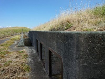
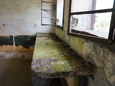
Motutapu, a complex of bunkers, tunnels, and observation posts stands abandoned, leftover from the 1940s and preparations for an invasion that never came.
In the language of New Zealand’s indigenous Māori people, the name Motutapu is derived from “Te Motu tapu a Taikehu,” the “sacred island of Taikehu” (a reference to a Māori ancestor). Located adjacent to the volcanic Rangitoto Island, it was a home and important site for centuries, and the Department of Conservation and the Motutapu Restoration Trust oversees a network of archaeological sites that date back to before an eruption that blanketed the island in ash 600 years ago.
After the Japanese appeared to be making it further and further south during WWII, the New Zealand government focused on it for another reason: its strategic placement in Auckland Harbour. Fearing a potential Japanese assault, the government spent millions of dollars to build fortifications along the coastlines throughout New Zealand. Motutapu’s strategic position, however, led to extensive defenses and the placement of some of the country’s most advanced artillery.
Today, many concrete structures remain nestled among the island’s national park and farmland. There are anti-aircraft gun emplacements, lookouts, communications and radar, and sleeping quarters. Dug into hills, some are signposted and indicated on maps, while others require a keen eye and adventure to find.